Thursday Weather: Strong Coastal Winds and Isolated Rain Forecast for Eastern South Africa
South Africans are advised to prepare for strong coastal winds and isolated rain in the eastern regions this Thursday. The transition towards spring brings typical late-August weather shifts across coastal and eastern provinces.
On Thursday, 27 August 2026, South Africans are advised to prepare for a shift in weather conditions, with reports indicating that strong coastal winds and isolated rain are expected to affect several parts of the country. According to initial weather reports published by local media outlet Independent Online (IOL), these conditions will primarily impact the coastal zones and the eastern regions of South Africa. While the transition from the winter season towards spring often brings unpredictable atmospheric changes, this latest update highlights specific areas of concern that residents and travellers should keep in mind throughout the day.
The timing of this weather pattern is highly characteristic of late August in South Africa. During this period, the country frequently experiences transitional weather systems where cold fronts lingering from winter interact with warming continental air masses. This interaction often results in increased wind activity along the coastal margins and localised precipitation in the eastern half of the country. While the initial report does not specify the exact meteorological causes—such as a passing ridging high-pressure system or a weak cold front—the symptoms of strong coastal winds and isolated eastern rains are typical of this seasonal shift.
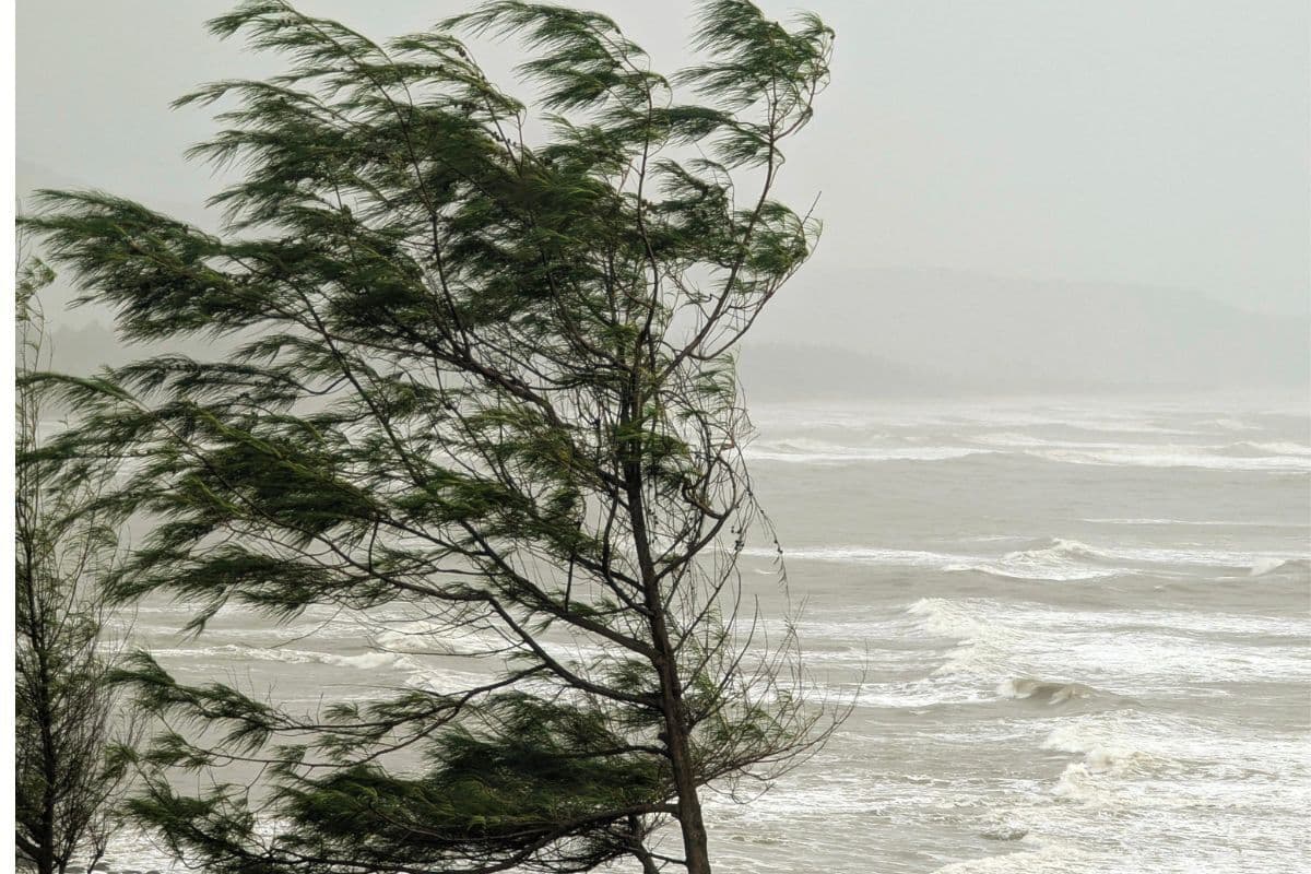
For those living along South Africa's extensive coastline, the warning of strong coastal winds is a key point of focus. Although the brief report does not specify which exact coastal provinces—such as the Western Cape, Eastern Cape, or KwaZulu-Natal—will bear the brunt of these winds, coastal wind alerts generally necessitate caution. Strong winds along the coast can lead to rough sea conditions, increased wave heights, and potential challenges for maritime vessels. Local port authorities and small-craft operators are typically advised to monitor these developments closely to ensure safety at sea.
Concurrently, the eastern regions of South Africa are slated to receive isolated rain. Geographically, the eastern parts of the country usually include KwaZulu-Natal, Mpumalanga, and parts of the Eastern Cape and Limpopo. The term "isolated rain" suggests that while rainfall will occur, it will be scattered and limited to specific localised areas rather than representing a widespread, continuous downpour. For agricultural sectors and local municipalities in these eastern provinces, even isolated rainfall can bring a welcome relief to dry winter soils, though it can also create sudden localised hazards if accompanied by sudden temperature drops.
In keeping with strict reporting standards, it is important to note that several specific details remain unconfirmed in the initial trend data. The report does not detail the exact wind speeds expected in knots or kilometres per hour, nor does it specify the anticipated rainfall volume in millimetres. Furthermore, no formal severe weather warnings or localised flood alerts have been attached to this specific update. To fill these gaps, South Africans are encouraged to consult official updates from the South African Weather Service (SAWS), which regularly provides localised district-level forecasts and impact-based warnings.
The practical implications of these weather conditions extend to daily commutes and outdoor activities. For motorists travelling along coastal routes such as the N2 highway, strong winds can create challenging driving conditions, particularly for high-sided vehicles, caravans, and motorcycles. Drivers are urged to maintain a firm grip on the steering wheel and increase their following distances. In the eastern regions where isolated rain is forecast, early morning or late afternoon commutes may be impacted by wet road surfaces and reduced visibility, requiring extra vigilance on the roads.
Beyond transport, localised coastal communities and beachgoers should exercise caution. Strong winds can blow loose debris and make outdoor coastal activities unpleasant or hazardous. While it remains unclear if these winds will reach gale-force levels, securing loose outdoor items around residential properties is a sensible precautionary measure. For residents in the eastern regions, keeping an umbrella close at hand and monitoring local sky conditions will help manage the unpredictability of isolated showers.
Looking ahead, South Africans should watch for further detailed updates as the day progresses. Weather systems during the late winter and early spring transition can evolve rapidly, sometimes intensifying or dissipating faster than initially projected. Staying informed through reputable local news sources and official meteorological channels will ensure that residents remain safe and prepared for whatever conditions Thursday brings to their respective regions.
Reporting record
How this story was produced
This article was AI-generated from the frozen trend evidence and passed deterministic quality and safety gates. No cross-provider evidence review or independent human verification is claimed for this record.
- Byline
- Newstrends AI Newsroom
- First published
- Last material update
- No later material update recorded
- Distinct source identifiers
- 1 retained source identifier
Frozen source links for this publication
Chronology
Story timeline
A generated chronology for orientation; dates and details may require source verification.
Update
Weather report published warning of strong coastal winds and isolated rain in the eastern regions of South Africa.
Reader file
Frequently asked questions
01Which regions are expected to experience rain on Thursday?
Isolated rain is expected in the eastern regions of South Africa, which typically include provinces such as KwaZulu-Natal, Mpumalanga, and parts of the Eastern Cape.
02Are there specific wind speed warnings for the coast?
The initial weather report notes strong coastal winds but does not specify exact wind speeds or wind velocity measurements. Residents should consult the South African Weather Service for detailed alerts.
03What precautions should motorists take?
Drivers on coastal routes should watch out for strong winds, especially when driving high-sided vehicles, while those in the eastern regions should prepare for potentially wet and slippery roads due to isolated rain.
Keep reading
Related coverage
More published reporting connected to this story.
Rain and Strong Coastal Winds Forecast Across South Africa This Wednesday
South Africans are advised to prepare for wet weather and high winds along the coast this Wednesday, 26 August 2026. While initial reports confirm the incoming weather system, specific regional impacts and warning levels remain unconfirmed.

WEATHER ALERT: Rain Forecast for KwaZulu-Natal and Two Other Provinces
Weather forecasts indicate that rain is expected to hit three South African provinces, with specific alerts issued for parts of KwaZulu-Natal. While the exact details of the other two provinces remain unconfirmed, residents are advised to prepare for wet conditions.

WEATHER ALERT: Cloudy, cold conditions and rain set to hit two South African provinces
A new weather system is forecast to bring cold, cloudy conditions and rainfall to two South African provinces. While the specific regions have not yet been named, residents are urged to prepare for a late-winter temperature drop.
Partly Cloudy Skies and Isolated Rain Forecast for South Africa
South Africans can expect a combination of partly cloudy conditions and isolated rain showers on Thursday, 20 August 2026. While regional specifics remain unconfirmed, the transitional weather pattern highlights the need for commuter caution.
Weather Alert: Morning Fog and Fresh Coastal Winds to Affect Parts of South Africa
Parts of South Africa are expected to experience morning fog and fresh coastal winds, impacting driving visibility and marine conditions. Residents and commuters are advised to exercise caution as localized details unfold.