South Africa Braces for Cold, Windy Wednesday as Weather Alert Warns of Possible Snow
A weather alert has warned South Africans to prepare for a cold, cloudy, and windy Wednesday on 12 August 2026. The forecast indicates that snow is also possible, though specific regional details remain unconfirmed.
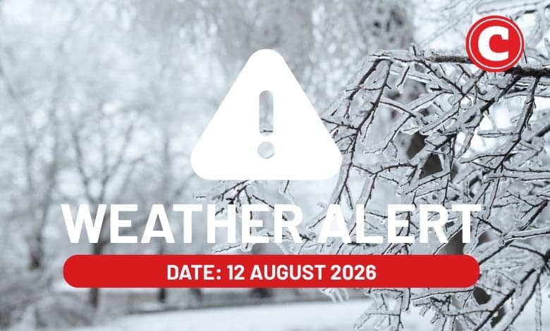
South Africans are advised to prepare for a significant shift in weather conditions as a new weather alert warns of cold, cloudy, and windy conditions across parts of the country on Wednesday, 12 August 2026. According to preliminary reports and forecasts published by local media outlet The Citizen, the mid-week weather system is also bringing the distinct possibility of snow, marking a cold snap for the region.
The weather alert, which was captured and flagged on Tuesday, 11 August 2026, highlights a rapid transition to harsher wintry conditions. While August often represents the transition period towards spring in South Africa, this latest system serves as a stark reminder that winter has not yet lost its grip. The forecast explicitly warns of three major elements coinciding on Wednesday: a sharp drop in temperatures, extensive cloud cover, and strong winds.
Perhaps the most notable aspect of this weather alert is the possibility of snow. While the initial forecast data from the publication confirms that snow is on the horizon for Wednesday, the specific high-lying areas, mountain ranges, or provinces earmarked for snowfall have not been detailed in the initial alert. In South Africa, winter snow typically affects high-altitude regions such as the Drakensberg, parts of the Western Cape, Eastern Cape, and Lesotho, but residents across all traditionally cold regions are urged to stay informed as local meteorological services refine their geographic predictions.
The combination of cold temperatures and windy conditions is expected to significantly lower the wind chill factor, making the outdoors feel substantially colder than the actual recorded temperatures. Windy conditions can also pose challenges for motorists, particularly high-sided vehicles on open freeways, and can exacerbate the risk of runaway fires if dry conditions preceded this system, although the accompanying cloudiness may bring moisture.
Because the available forecast data remains high-level, several critical details are still to be confirmed by official meteorological bodies like the South African Weather Service (SAWS). It remains unclear exactly how low the temperatures will drop in major metropolitan areas such as Johannesburg, Pretoria, or Cape Town, or if any formal weather warnings—such as Level 1 to Level 10 yellow or orange alerts—have been officially declared for damaging winds or disruptive snow.
In the absence of localized details, South African residents are encouraged to take standard precautionary measures for cold and windy weather. This includes ensuring that heating appliances are used safely to prevent domestic fires, keeping pets indoors or sheltered from the biting wind, and checking on vulnerable members of the community, such as the elderly and those without adequate shelter.
For those planning to travel between provinces on Wednesday, particularly through mountain passes where snow is possible, extreme caution is advised. Wet, windy, or icy roads can drastically reduce visibility and vehicle traction. Keeping a close eye on live road updates and traffic alerts will be essential for anyone commuting through areas susceptible to rapid weather changes.
As Wednesday, 12 August 2026 progresses, the full impact of this weather system will become clearer. South Africans should keep their winter wear close at hand and continue to monitor updates from reliable local news sources and official weather channels. Whether this system delivers a light dusting of snow or a more severe wintry blast, staying prepared and informed remains the best defense against the elements.
Reporting record
How this story was produced
This article was AI-generated from the frozen trend evidence and passed deterministic quality and safety gates. No cross-provider evidence review or independent human verification is claimed for this record.
- Byline
- Newstrends AI Newsroom
- First published
- Last material update
- No later material update recorded
- Distinct source identifiers
- 1 retained source identifier
Frozen source links for this publication
Chronology
Story timeline
A generated chronology for orientation; dates and details may require source verification.
Update
Weather alert published warning of incoming cold, cloudy, and windy conditions with possible snow.
Update
Expected onset of the cold weather system across South Africa.
Reader file
Frequently asked questions
01When is this cold weather expected to hit South Africa?
The weather alert is specifically for Wednesday, 12 August 2026, following forecasts published on 11 August 2026.
02Where is the snow expected to fall?
While the alert indicates that snow is possible, the initial forecast data does not specify which exact provinces or high-lying areas will receive snowfall.
03What conditions are expected alongside the cold weather?
In addition to cold temperatures, the weather alert warns of cloudy and windy conditions across affected areas.
Keep reading
Related coverage
More published reporting connected to this story.
Severe Weather Alert: Cold, Wet, and Windy Conditions Expected for the Long Weekend
South Africans are being warned to prepare for a significant drop in temperature along with wet and windy conditions ahead of the upcoming long weekend. The severe weather alert has prompted calls for caution, particularly for those planning to travel. Residents are advised to monitor official updates as the weather system develops.
South Africa Braces for Fine but Cold Saturday with Alerts for Damaging Coastal Winds and Waves
A national weather alert has been issued for Saturday, 1 August 2026, warning of fine but cool to cold conditions alongside damaging coastal winds and waves. Coastal residents and marine users are urged to exercise extreme caution as adverse conditions develop.
Thursday’s Weather: Fine and Cool Conditions with Showers Forecast for Parts of South Africa
South Africans can expect a combination of fine, cool weather and localized showers on Thursday, 6 August 2026. While the exact regional breakdown remains unspecified, the transitional August weather highlights the need for cautious driving and layered clothing.

KZN Weather Alert: Strong Winds and Dangerous Waves Forecast for Coastal Parts
Parts of KwaZulu-Natal are bracing for adverse weather as reports warn of strong winds and dangerous waves. Residents, beachgoers, and maritime operators along the coastline are advised to exercise caution.
South Africa Braces for Damaging Winds and Waves as New Weather Alert Issued
A nationwide weather alert has been issued for 30 July 2026, warning of damaging winds and waves. South Africans are advised to prepare for adverse conditions alongside partly cloudy skies.